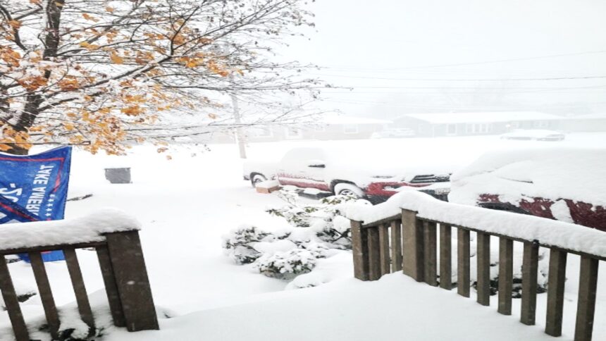
A powerful snowstorm is making its presence felt across upstate New York and northern Michigan, bringing heavy lake-effect snow that could have significant impacts on holiday travel and weekend activities. From the shores of Lake Ontario to the Upper Peninsula of Michigan, residents and travelers are bracing for dangerous conditions, with the snow expected to continue through the weekend.
Lake-Effect Snow Hits New York Hard
In New York, the first major snowstorm of the season is making its way through the state, threatening to bury towns along the shores of Lakes Erie and Ontario. Weather experts predict that some areas could experience up to 6 feet (1.8 meters) of snow by the time the storm clears. The hardest-hit areas will be to the east of Lake Ontario, with places like Watertown seeing 4-6 feet (1.2-1.8 meters) of blowing and drifting snow through Monday.
The lake-effect snow is particularly intense due to unusually warm conditions in Lake Erie. The lake’s water temperature is around 50°F (10°C), which is higher than usual for this time of year. When the warm, moist air from the lake meets the colder, drier air above, it creates perfect conditions for heavy snowbands. These bands can produce snowfall rates of up to 2-4 inches (5-10 cm) per hour, making driving treacherous and reducing visibility drastically.
In Erie County, which includes Buffalo, the forecast calls for 2-3 feet (0.6-0.9 meters) of snow by Sunday evening. Erie County Public Works Commissioner William Geary noted that the unusually warm lake temperatures are contributing to the intensity of the storm. We’re experiencing these strong lake-effect occurrences because we’re approximately six degrees warmer than we should be at this time of year,” Geary said. “We’ll probably see more of this through December.
Impact on Travel and Road Closures
The snowstorm has caused significant disruptions to travel in upstate New York. On Friday, snow began falling heavily, causing hazardous driving conditions and leading to the closure of major highways. Interstate 90, a key route through the region, was closed, and commercial vehicles were banned from certain roads, including US Route 219 and Interstate 86. “There’s a considerable number of vehicles going off the road on the 219 currently,” said Gregory Butcher, deputy director for preparedness and homeland security in Erie County. Authorities are using ATVs and snowmobiles to assist first responders as needed.
Governor Kathy Hochul declared a disaster emergency for the affected counties, enabling state agencies to mobilize resources quickly to help with snow removal and emergency response efforts. As the storm continues, officials are urging caution on the roads, as snow and ice are expected to create further travel difficulties.

Volunteers Needed for Buffalo Bills’ Snow Shoveling Effort
In a bit of a unique twist, the Buffalo Bills have called on volunteers to help shovel out Highmark Stadium in preparation for their Sunday night game against the San Francisco 49ers. The team anticipates up to 2 feet (0.6 meters) of snow on the field by kickoff. Last year, a similar storm forced the NFL to reschedule the Bills’ playoff game from Sunday to Monday, and the team is hoping to avoid further delays this time. Despite the storm’s challenges, the Bills are preparing to play in any conditions.
Erie County Executive Mark Poloncarz said the snowstorm will likely be winding down by game time, though conditions may still be difficult for fans traveling to the stadium. “It’s going to be slow going, there’s no doubt about that,” Poloncarz said. We’re still anticipating snow in the area, but the heavier snow should be gone before kickoff.
The Bills, sitting at a 9-2 record and aiming for their fifth straight AFC East title, are determined to proceed with the game as scheduled. Head coach Sean McDermott emphasized that the team is doing everything possible to stay on top of the situation and be ready for the game.
Traveling Upstate for Thanksgiving? Be ready for 4-8” of snow on Thursday and major lake effect snowfall through the weekend. pic.twitter.com/e0XtsRaQNN
— John Davitt (@johndavittontv) November 26, 2024Michigan’s Upper Peninsula Faces Heavy Snowfall
To the west, Michigan is also feeling the effects of the storm. Lake-effect snow has already blanketed parts of the Upper Peninsula, with some areas reporting over a foot (0.3 meters) of snow by Friday afternoon. Meteorologists expect the snow to continue through the weekend, with some areas potentially seeing up to 3 feet (1 meter) of snow by Monday.
The National Weather Service in Gaylord, Michigan, reported that a strong northwesterly wind is contributing to the snowstorm’s intensity, creating ideal conditions for the prolonged snowfall. Gusty winds near the Great Lakes are also reducing visibility, and the NWS is urging drivers to take caution when traveling. While the storm has caused difficult driving conditions, there have been no major accidents reported as of Friday.
Looking Ahead to the Weekend
As the storm continues to unfold over the weekend, both New York and Michigan will likely see further disruptions to travel and daily life. Snowfall amounts could exceed predictions in some areas, making it crucial for residents to stay updated on weather alerts. Authorities are monitoring conditions closely and preparing for possible road closures and additional emergency responses. With a little help from volunteers, the Buffalo Bills are hoping to weather the storm and keep their game on schedule, but the rest of the region will need to stay vigilant as the winter weather unfolds.
Read More : Mexico Responds to Trump’s Tariff Threat, Hinting at Retaliation Amid Market Turmoil


